|
The Military Burying Ground that forms part of Victoria Memorial Square today was opened in 1794 or thereabouts. It functioned until early 1863 as a place of interment for an estimated 500 soldiers, their wives and children and a few civilians. Located some distance from the both the original and second Fort York, it was at first just ‘a clearing in the brushwood.’ Later, after the forest cover had been removed for defensive reasons from the Ordnance Reserve, the cemetery was a picket-fenced enclosure there.
The park surrounding the burying ground was created by Lt. Gov. Sir Francis Bond Head in 1837 in laying out a portion of the Ordnance Reserve for better-than-average residential development. Called “Victoria Square” to honour Princess Victoria, the heir apparent, it was paired with the smaller Clarence Square at the other end of Wellington Place that recalled King William IV’s days as the Duke of Clarence. Originally six acres in size, Victoria Square was bounded by Bathurst, Stewart, Portland and Niagara streets. It was intended to be a place “in which Churches may be hereafter erected but without grounds attached thereto,” whatever that meant.
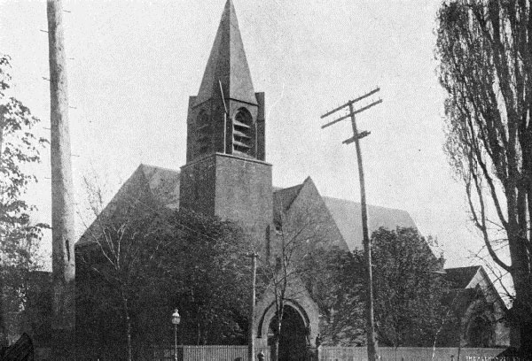
The first church built there was the Anglican Church of St. John the Evangelist. It was a board-and-batten structure in simplified Gothic style, erected in 1858 on Stewart Street under a license of occupation from the Officers of H. M. Ordnance. Three years later, in 1861, the Crown granted unconditionally to the Church Society of the Anglican Diocese of Toronto all the lands, two acres in total, bounded by Douro (Wellington), Bathurst, Stewart and Portland streets, including the site of the church. On 8 Nov. 1870 Churchwardens of St. John’s Church registered plan D-86 and effected a subdivision of the west end of their lands.
The Crown itself was responsible for two other subdivisions that further reduced the area of the square to its present 2.05 acres. On 23 Sept. 1871 it registered plan D-110 creating fifteen 25-foot lots on Bathurst St. between Niagara and Douro streets, and east along Niagara Street. On 12 Oct. 1874 plan D-200 was registered to continue Douro Street east through the square. Although the street was used from about this time, it was considered to be part of the square and not opened as a public highway until after the 45-foot allowance was patented by the Crown to the City of Toronto on 11 March 1950.
The last burial in Victoria Square took place in 1863, when it was deemed full and the Strachan Avenue military burying ground was opened. The Square continued to be owned by the Government of Canada, which took little interest in keeping up the grounds. Indeed, about 1871 the Minister of the Interior rented “the external square of land surrounding the cemetery” for twenty-one years on condition that the lessee fence and secure the cemetery. It appears that the lessee moved one old house to a site on Portland Street opposite Wellington Place, but lost interest after that. His failure to discharge his fencing obligations was the reason given for cancelling his lease in 1886.
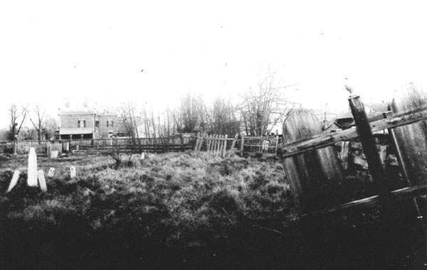
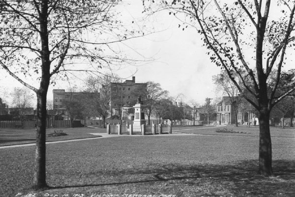
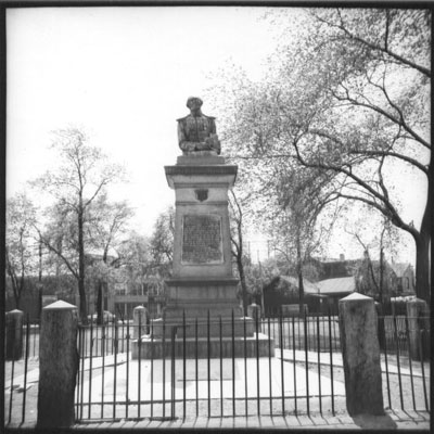
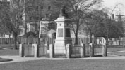
Meanwhile, there was increasing pressure from religious and civic leaders to show respect for the dead by improving the maintenance of Victoria Square. In 1884 the City appointed a Military Burial Ground Commission under the chairmanship of Colonel William Otter of the Infantry School at Fort York and charged it with preserving the cemetery. It commissioned a survey of the 344 burial mounds that were visible then, after which it took steps to raise the level of the ground to improve the drainage. The land then began to be used as a public park. Towards the end of the 1890s the Army&Navy Veterans’ Association started to collect monies for the erection of a monument in the square, which was accomplished in 1902. About 1905 the Association persuaded City Council to change the name of the park to Victoria Memorial Square.
In 1938 the City entered into a dollar-a-year lease of the square, known municipally as 10 Niagara Street, for parks purposes. Since then the leases have been renewed annually. In 1964 the municipality took the initiative to ask if the Federal Government was disposed to sell the square, but nothing came of its enquiry. In 1986 Public Works Canada declared the property surplus to the needs of the Federal Government but the sale became bogged down in red tape. By 1991 the offer to sell had been withdrawn and the annual leases continued. In 1990 the Square was included on the City’s Inventory of Heritage Properties.
Excerpt from:
Fort York: A National Historic Site
Metes and Bounds: The Designation of Place
A Briefing Report prepared for a workshop, October 29, 2002
(paragraph headings added by WPNA)
[In 2003 the Historic Sites and Monuments Board of Canada declared Victoria Memorial Square to be part of the Fort York National Historic Site]
|
|
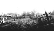
Cemetery circa 1885
Toronto Public Library
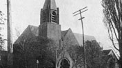
St. John's Church, Stewart Street.
1892-1964
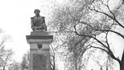
The park in 1913.
Photo: A.S. Goss, City of Toronto Archives
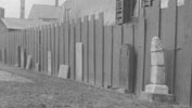
Memorial Terrace of surviving headstones at west end of park, 1922
War of 1812 Monument, May 1953, showing headstones set in concrete.
Photo: J.V. Salmon. Toronto Public Library
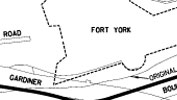
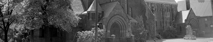
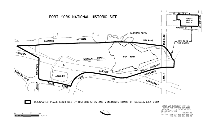
Fort York National Historic Site. Now includes Victoria Memorial Square. 2003
|